

The Cypress Hills, straddling the Saskatchewan/Alberta border, rank among Canada’s top destinations for photography. Here we’ll focus on one of our favourite parts of the hills – the West Block of Cypress Hills Interprovincial Park, which is on the Saskatchewan side, next to the Alberta border. While photo possibilities are almost endless, these are our 5 top photo sites for camera buffs.
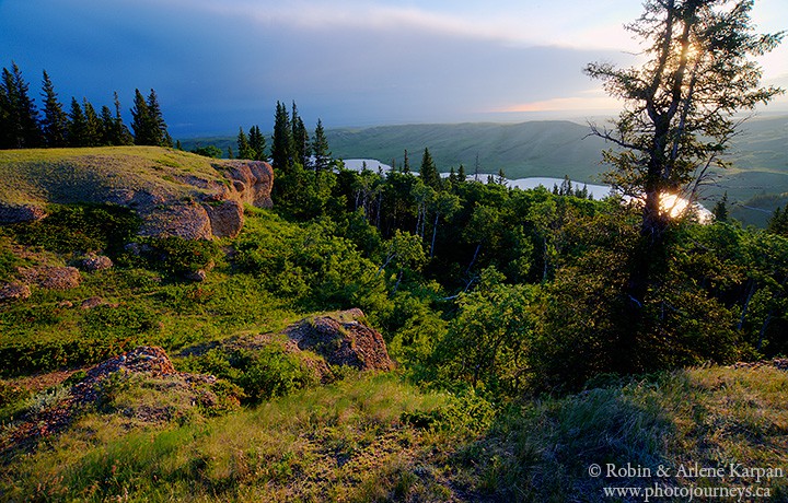
1) Conglomerate Cliffs at Sunrise
One of the easiest places to visit in the West Block, you can drive right up to the conglomerate cliffs. The cliffs consist of smooth, water-worn stones naturally cemented together. Exposed edges have been eroded, leaving steep banks with millions of pebbles looking like they’re encased in concrete. They are worth seeing at any time of day, with the hour or so just before sunset being especially nice when low light saturates the green rolling hills east of Adams Lake. But the undoubted highlight is sunrise, which in mid-summer is well before 5:00 am. In summer, the sun clears the horizon on the lower land north of the hills in the Centre Block, so it shines up at the east-facing conglomerate cliffs, immediately bathing them with a warm glow. The reddish tinge on the cliffs is accentuated by the low saturated light. Throw some storm clouds into the mix, as we had one morning, and the result can be quite spectacular.
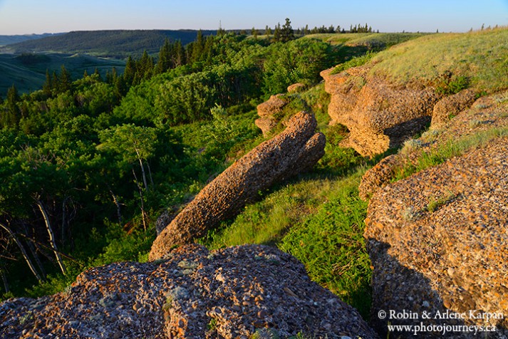
2) Hidden Conglomerate Cliffs
These are a separate set of conglomerates, facing south over the Battle Creek valley. They’re called “hidden” because they are obscured by thick forest and you can’t see them as you drive along the valley road. There’s two options to access the cliffs. One is to hike a portion of the Trans Canada Trail that passes by these formations. The easiest access point is from Battle Creek Road. Just a couple kilometres short of the Alberta border, the trailhead starts immediately across the road from an old log building. It’s a bit of a climb up to the valley rim, but the views are well worth the effort. The second way is to access the cliffs from the top along a very minor road that may or may not be passable. This should only be attempted in dry weather and if you have a vehicle with high clearance. The road is quite bad so the park no longer publicizes this route. However, if you do drive here, there is a sign indicating where to park. The cliffs are only a half kilometre or so walk across level pasture. The best time for photography is early to mid-morning. Don’t rush to get here immediately after sunrise, since the sun needs an hour or more to clear the hills to illuminate the cliffs.
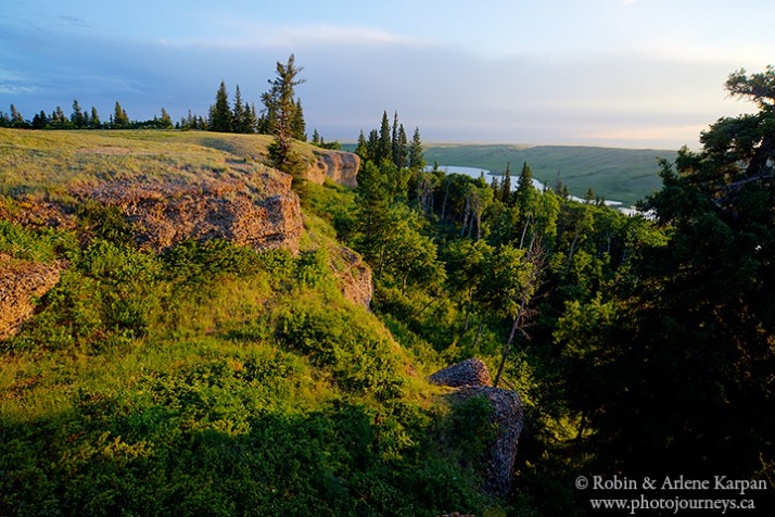
3) Battle Creek Road
Battle Creek is one of the shorter waterways on the prairies, but definitely one of the prettiest. The narrow creek meanders across the broad valley, bordered by the Cypress Hills’ distinctive and attractive mix of prairie grasslands and forest. In many places the little creek is almost hidden beneath the canopy of spruce trees. The West Block’s two campgrounds are both pleasantly situated beside the creek.
Battle Creek Road, the main route through the West Block, parallels the creek most of the way, with several spots to get out to explore. Photo possibilities are many, from the creek itself to the mix of forest and prairie, spectacular wildflower displays, and some of the highest hills in the park. The road continues west into the Alberta side of the interprovincial park.
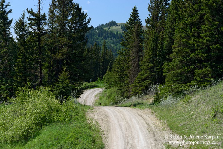
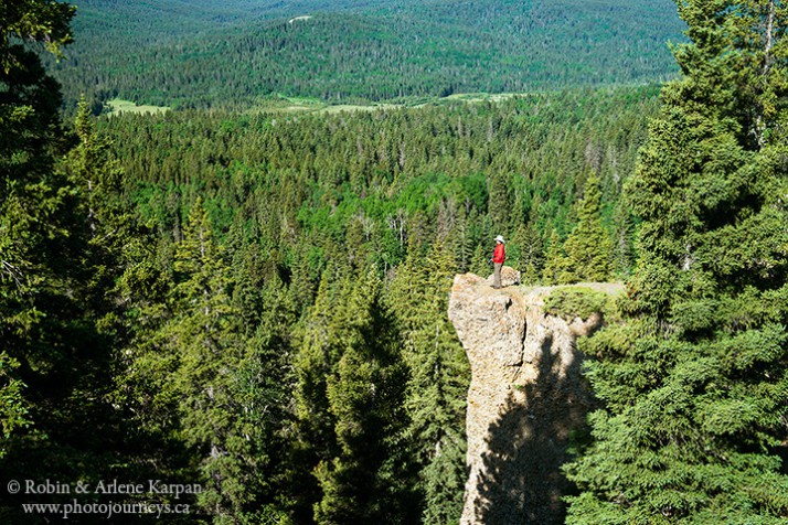
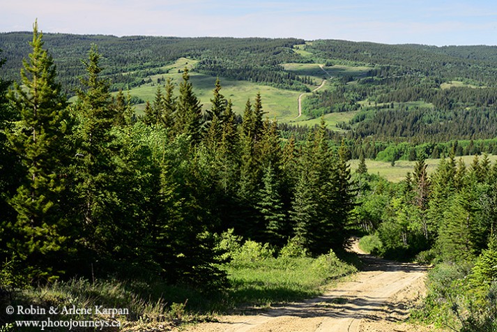
4) South Benson Road
A few minor roads branch off from Battle Creek Road and head into the hills and up the valley slopes. Our favourite is South Benson Road, which begins a short distance after driving west from the campgrounds. Very rough and deeply rutted, this road is not for everyone. It should only be attempted in dry weather and if you have a vehicle with high clearance (preferably with four-wheel drive). But the views from the top are breathtaking. If you’re not comfortable with driving, it would be worthwhile walking part way up. Indeed, a portion of the Trans Canada Trail takes you up the road a short distance to access the hills beyond.
5) Fort Walsh
While this is technically a National Historic Site rather than being part of the interprovincial park, Fort Walsh is immediately next to the West Block, and for all intents and purposes is an integral part of the visitor experience in coming here. For details, see our previous posting.
Absolutely stunning photos of several scenic places in the Cypress Hills! Thanks Robin and Arlene Karpan.
By the way, Fort Walsh Nat’l Historic Site, while a federal site, is one of the three park partners that officially make up the “interprovincial” park.